Thursday, March 15, 2012

2012 - Pacific Crest Trail - South of Highway 74

Trail Overview

Zigzagging its way from Mexico to Canada through California, Oregon and Washington the Pacific Crest Trail (PCT) boasts the greatest elevation changes of any of America's National Scenic Trails, allowing it to pass through six out of seven of North America's ecozones including high and low desert, old-growth forest and alpine country. Indeed, the PCT is a trail of diversity and extremes. From scorching desert valleys in Southern California to rain forests in the Pacific Northwest, the PCT offers hikers and equestrians a unique, varied experience.

Whether you visit the PCT for a few hours or for a few weeks you'll surely find a uniquely Western scene that will rejuvenate, inspire and surprise you. Two thousand six hundred and fifty miles of adventure and discovery are waiting.
For the complete overview visit:  http://www.pcta.org/about_trail/overview.asp .
The hike we took was quite a bit less than 2650 miles, in fact it was only 4 miles.  The parking lot for the trail sits at 4900 feet above sea level and the elevation gain is 200 feet making it an easy hike.  The views along the trail were beautiful and a good change from the desert vegetation.


The mileage marker heading south. We made it halfway to Table Mtn. road.

Elevation profile of the hike - starting from left to right - the center of the profile was our destination.

View looking north at San Jacinto Mountain.

I have always wondered what this tree is... might be an Arizona Cypress.

After we made it up to the ridge we had this view to the Southwest

This was the view Northwest.

Indian Paintbrush - I think there are more that 4 species of this plant.

We stopped our hike here where the trail skirts the embankment.

The view south was a bit hazy so we couldn't see Mexico but we could make out the first destination on the mileage board.

We had a discussion about the light green buds and wondered if the cactus had already flowered. 

Our group had 12 people today and we were spread out along the trail in twos.


Young shoots of a Manzanita.

I think this is called an Nolina (agave family).  Below picture is of the plant's tip.


I think this is a mature Nolina, flowered last year and dying.  We will be back next year to see what happened to the one trying to flower this year.

This was the last hike down in the Palm Springs area for this year.  I hope to have lots of hiking upon Vancouver Island this spring and summer.

Thursday, March 8, 2012

2012 - Little Painted Canyon

The Little Painted Canyon and Ladders hike is almost the same length of hike (5 miles) as the the Big Painted Canyon.  When you get to the top of the ridge after going through the ladders you drop over the left bank.  The usual route is to the right and is a gentler trail to the Big Canyon. 

The Ladders continue to amaze first time hikers because of the narrow passages and the quick change in altitude attained by using ladders.  In many locations you can walk along ledges and see the progress of the team below.  Not many took me up on a look over the edge.

The Little Painted Canyon is narrower than the big one and has many interesting features you don't see in the other. 


Option Two was to walk through a gap in the boulders.

Option One is to climb over the boulders and take a ladder down

Waiting below for the ladder to take you up about 30 feet

Of course the ladders don't go right to the top and you have to do a bit of a scramble

A view down on the zig-zag canyon
 I have inserted many photos of the plants that are currently in flower.  There aren't a huge amount this year due to the lack of rain.

Creosote Bush

Brittle Bush

Beavertail Cactus

Brown-eyed Primrose

Second to last ladder, getting close to the top

Start of the Little Painted Canyon - Over the bank for a scramble and slide

Ocotillo bloom

Wild Heliotrope

Ghost Flower

Bee on the Lavender Bush

Interesting monolith to walk around

More zig-zag canyons

OK! Where's the exit here?

Canyon opens up at the bottom and the cars are parked around the corner to the left.

Thursday, March 1, 2012

2012 - Araby Trail - A view from Bryan's Eyes

The Araby trail is often used by locals for endurance training.  It rises quickly to 1000 feet and the modified hike that the group took rises to 1400 feet and a distance of 5 miles.  Some of the group turned back at the top of the Araby but were still rewarded by great views and the knowledge that they had completed the toughest part of the trail.

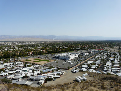
The start of the trail takes you through an easement between the rich show homes and the poorer mobile homes.

We also leave behind car lots

The trail up is very exposed to the sun but the group started off with a cool morning.

Always a favorite of this hike - Bob Hope's old home

Nice view you had Bob...

This was the first time up here for most of the hikers and they thought my rating system was a bit off.  The book said 'Moderate' but the group consensus was more to 'Moderate/Strenuous'

Resting at the highest part of the hike - Smoke Tree Mountain

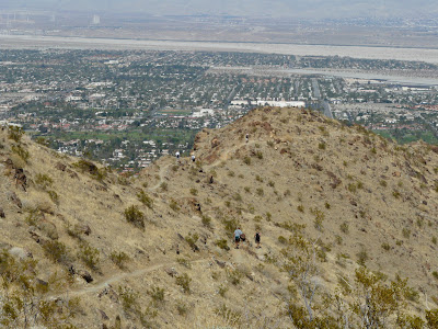
Lots of hikers out on the trails today!

Picture of the rich people homes from the Shannon Trail

The last section of trail is the Henderson and you have to share it with horses.  I am sure that some of the group wished they were riding this one back down the wash to their cars.