Saturday, January 26, 2013

Ancient Lake Cahuilla - Fish Traps

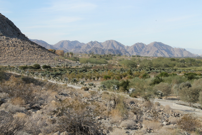
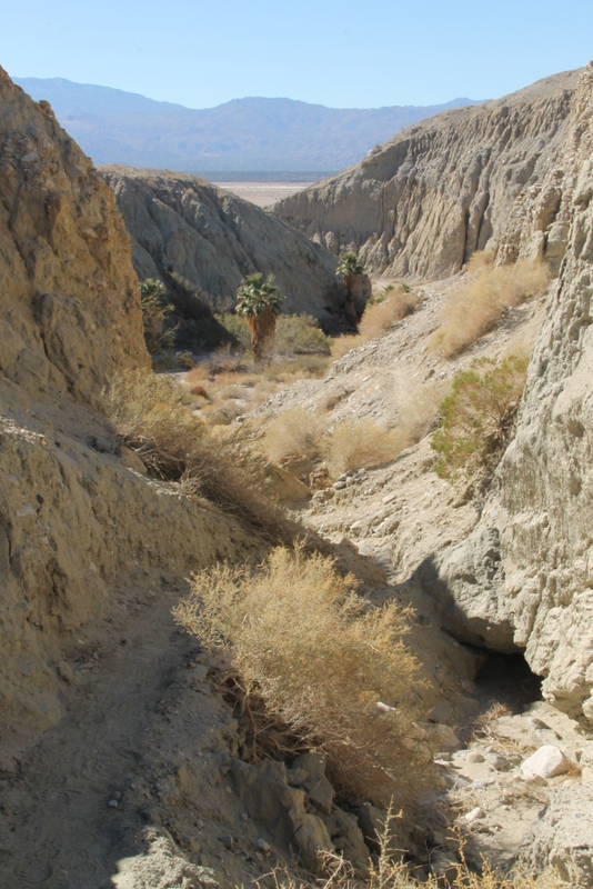
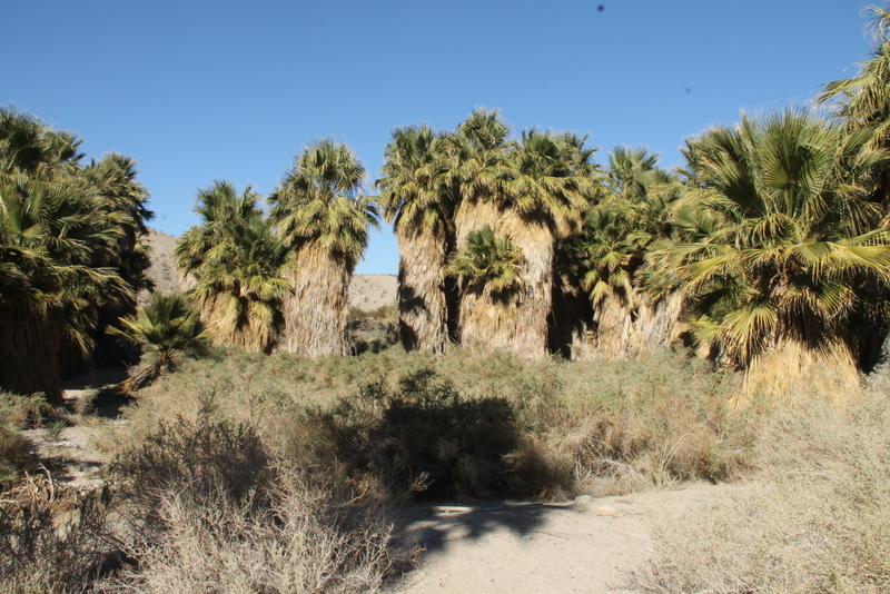
Ancient Lake Cahuilla filled the Imperial Valley from the Colorado River Delta in Mexico north to Indio. It is thought to have reached a depth of 300 feet. This fresh water lake would have been six times the size of the current Salton Sea.  I was reminded of this site by an article about Earthcaches http://earthcache.org/ on the Geocaching newsletter.

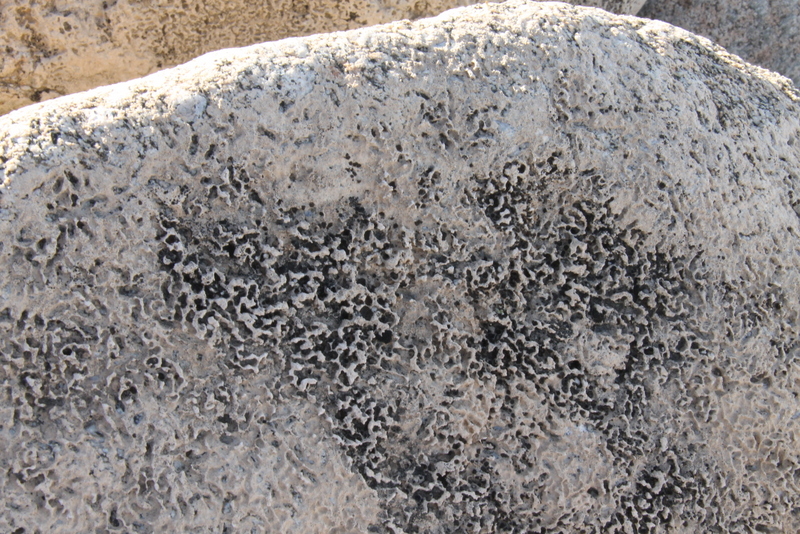
Evidence of the shore line can be seen today at the southeastern edge of Indio.  The water level was about 40 feet deep at this point.  The rocks below the old waterline are covered by travertine deposits.  Travertine, sometimes called tufa, is a freshwater lime deposit.  It is formed in waters that have a lot of calcium carbonate (what makes up shells) and algae. The algae uses the carbon dioxide from the calcium carbonate in photosynthesis leaving the lime.

Evidence of Lake Cahuilla's gradual evaporation can also be seen at the coordinates. In this case the evidence comes from what archaeologists have interpreted to be Native American fish traps. These traps are roughly circular piles of rocks that were built along the shore of the lake. Fish would swim into the circle and have a hard time figuring out which way to swim back out of them.

The coordinates bring you to a line of traps built along the hillside at about the same elevation. If the archaeologist's interpretation of the rock piles are correct, the shoreline of the lake would have been at this elevation at the time these traps were used. As you can see these traps are below the high water mark shown by the presence of travertine on the rocks.

A little investigation around the coordinates and you can find other lines of traps at different elevations. The interpretation is that as the lake level fell due to evaporation, another set of fish traps would have to be made since the traps at the higher elevation would no longer be in the water and would be useless as fish traps.


Water level indicated by the ring of colour on the surrounding hills.  It is similar to the ring kid's leave on a bathtub after playing outside all day.


Newer fish trap

Travertine deposits

It is easier to see the pattern fish traps from above.

Travertine deposits can be over  1/2 inch thick.

Older fish trap higher up on the hill side.


Big Split Rock Slot Canyon Walkabout

Slit Rock Canyon is an excellent representative hike of the exotic geology found in the Mecca Hills. A fun adventure, especially for kids, this hike includes perhaps the longest slot canyon in the desert, accented at the end by a huge split mountain only several feet wide that hikers nimbly negotiate in order to see a San Andreas Fault fracture up close and personal. The walkabout section enhances the experience with exotic sculptured rock formations, colorful boulders, and soaring canyons. 

The above was the description from the book, '140 Great Hikes in and near Palm Springs' but it didn't say how much fun someone over 60 would have.  Some of us didn't go all the way in to some of these tight spots. I hope next time you guys will act more like kids, just because you body doesn't bend the same as it used...

Walkabout entrance

There are many places where the canyon opened to relieve  the hiker's claustrophobia.

How secure are those rocks?

The trail here was under a huge overhang.
The picture below is of the overhang's ceiling.


Tight enough?

Bigger hanging rocks

Some places a few got a hand up

Tight enough? Yes

It was when we had to crawl as well that we turned back.  Someone said they could see light at the end of the tunnel though.

Boulders that can't hang anymore must be climbed on or around.

View back down the canyon

Mesquite bush with a few beans still on the plant.

Colorful rocks at the canyon opening


Friday, January 25, 2013

Hidden Palms Oasis

Hidden Palms Oasis is part of the Coachella Valley Preserve trail system.  We had a great time finding the hidden palms among all the other oases in the area.  We took a loop of trails that was about 6 miles long but it could be shortened up depending which trails you chose.

We hiked along a ridge and down to the end bottom end of Pushawalla Oasis and then found a new trail up the canyon wall to the end of the Horseshoe Oasis from this point the Hidden Palms were almost a mile off to the southwest.

Indian Palms to the north of the ridge

Horseshoe Palms

Thousand Palms

San Jacinto Mountains

Lizard pointing the way down the trail

New trail up from the canyon


Mistletoe has some berries forming on the branches 

Horseshoe Palms up close

A first look of the Hidden Palms arriving from the east.

Nice cluster of palms

The center of the oasis

This is the view of the Hidden Palms you see when you come from the Northwest trail

The palms are hiding just around the corner giving the impression that you might be on the wrong trail.  We met a few couples around this area and they were sure they were lost.

Saturday, January 19, 2013

La Quinta Cove to Lake Cahuilla

The first time we hiked this trail it was quite warm and tiring. We thought it was only 5 miles so after consulting the hike description found 6 miles was more accurate.  I measured the hike again today and it is actually 6.5 miles and a gain of elevation of 580 feet from Cahuilla Lake.  The lake sits about 6 feet below sea level.

All our hikers made it even though some of the trail was like walking on a beach with loose sand.  They can brag to their children and grandchildren. The hike starts at the top of a subdivision; over a low pass and down a canyon. The trail through the canyon runs alongside of a golf course 'The Quarry' and on to the lake.

Cahuilla Lake is at the end of the canal system and is man made not to be confused with the ancient lake of the same name.  It is stocked with trout and there is a small campground and recreation area.  We enjoyed the picnic and toilet facilities although the women were stuck with a Johnnie on-the-spot as their side was under renovation.

Heading east into the sun and over the low pass.


A look behind from the pass at a small oasis in the center of the photo.

Canyon view - Lake is around the corner to the left.  Salton Sea is hidden in the smog off in the distance.

Only steep hill on the entire hike.

Palo Verde in the background with a cluster of barrel cactus and Teddybear Cholla

Stallion standing guard over the golf course

A few of the hikers inspecting the course.


Picnic area

Easy to tell this is a man-made lake.  Lots of birds enjoy the lake.  There were even a large flock of pelican.  


Back to the trail and golf course.  They have left some of the old equipment from the quarry.

This is the view of the stallion from the golfer's perspective.  If the game isn't going well you always have the view to enjoy.

A parting shot of the canyon and valley.  Pretty well all down hill to the cars from here.


Tuesday, January 15, 2013

Murray Hill via Jane Hoffbrau

I am always open to a new hike and when someone told me about the Jane Hoffbrau Oasis I figured this was a perfect time to have a look.  It was about 2.5 km in to the oasis and the elevation gain was 157 meters (515 ft.).  The next part of the hike took us up to Murray Hill and some spectacular views.

Looking down into the oasis from the trail junction.


We tried to hike up through the oasis wash but commonsense overtook our youthful enthusiasm.


As with palm trees in an oasis they are very prone to fire.

Views from halfway up the hill


From this angle it looks like we hiked to the same height of the mountains behind.  

There was a cool breeze but we sat out at the far table and enjoyed the view before heading back down.

This view of San Jacinto Mountains as well as the easy route along the ridge to the top of Murray Hill.  

This is the vertical profile of the hike.  From the start on the left side to the right you might see that we didn't go back the way we came as the return profile has a higher profile.

The total distance of this hike was 7 miles and a vertical gain of 1880 feet.