Friday, February 25, 2011

2011 - 09 Joshua Tree - Hidden Valley and Barker Dam

My last hike of the Snowbird season was actually two short loops in Joshua Tree Park.  The first was Hidden Valley named either because the area is framed in by rock walls or the fact that in the 1800's rustlers used to hide cattle here.  The natural vegetation is coming back in this area and it was good to wander through reading the posted signs to find out a bit more information about what we were looking at.


The entrance to the valley is not obvious. If you took away the fenced in path you would have to be facing due west to see the valley opening.


Trees get their water by running long roots through the cracks in the rock.


This is what you see as you enter the valley


Some of the rock walls that hide the valley.  It is amazing the variety of rock forms that have been created.


Prickly Pear Cactus


This rock formation is called the 'Big Burrito'.  Rock climbers named this giant; probably by someone hungry for some good Mexican fare.


The Joshua trees lend themselves to the landscapes vertical beauty


The hiking trail is made up of sand and small stones of granite that have worn off the surrounding rock.


The pinyon pine cone was used by the first natives as a valuable food source.  They would knock down green cones and burn them so the cones would open and the seeds could be extracted.  You won't get any out of this one as it appears to have already opened.


Standing on the saddle of the valley entrance you can see the Joshua trees growing all over the plain below.


Rock climbers have made it to the top and are enjoying a well deserved view.  Below you can see the Hidden Valley picnic area.


An Antelope Ground Squirrel watching us eat some lunch in the Barker Dam parking lot.  He probably did his rounds after we left for our hike.


A hummingbird trying to gather some warmth from the sun.


Why you don't want to fall into a cactus...


More unique rock formations

Panorama of the Barker Dam Basin.  The dam was built in the early 1900's to hold water for cattle and mining.  There was no water source just rain water fed and it is now used by all the wildlife in the area.


A moment to reflect


Dam Inspectors?

The Dam Face looks like there has been some maintenance or they did a great job during construction for it to look so strong.

The cattle trough was feed by a pipe from the dam. It is located at the base of the dam in the wash area.


This natural cave is a site of petroglyphs.  It is unfortunate that some visitors figured they would look better coloured.


Friday, February 18, 2011

2011 - 08 Araby Trail

The Araby trail is located in the Santa Rosa Mountain range and its route is in a canyon adjacent to the Bob Hope's estate (or who ever owns it now).  As we looked down over the houses I didn't see any that I wouldn't like to live in as the views are great. 

The hike should actually be called the Araby, Berns, Garstin, Shannon and Henderson Loop trail as we climbed up Araby and connected with the other trails that spread out over the range like a giant cobweb.  We walked approximately 5 miles and had an elevation gain of 1200 ft. most of the time we were zig-zagging up or down the hillside.

The trail went up through a canyon to a ridge before dropping back to a small wash before ascending up to a hill top where we stopped for lunch. On the way back down we walked along a ridge to the west that skirts the Indian Canyons.  The only part of the hike that wasn't enjoyable was the walk back to the truck along the Palm Canyon wash.  The wash reminds me of walking on a soft sandy beach, two steps forward and one back. 

View south up Southridge Drive


The homes on the lower part of the drive have a bit of a view


I'm not sure if this grass is native but it is pretty and it does a great job fighting against erosion


The bees were having fun drawing pollen from this plant (Fagonia)

A picture looking up with envy.  I wouldn't want to pay their taxes though.

Beaver Tail Cactus getting ready to bloom vivid rose-pink or reddish-lavender flowers


Bob Hope's estate, bottom left of photo.  He certainly had a nice view of the valley


After reaching the top of the ridge we had to go down to the bottom of the hill facing us and follow the zig-zag back up.  We then crossed the ridge to the hill at the far right of the photo.
 
This lizard thought he was doing a good job of camouflage


During the lunch break I took this picture of the trail we would be heading back along.  Some portions of the trail get very close to a steep edge and that can make some folks a bit uneasy


My hiking partners enjoying the ridge walk

Indian Canyons Golf Resort on the left of the road and Canyon Country Club on the right

This photo gives you an idea how steep the terrain is between switch backs


Baby Barrel Cactus (Fishhook)


Another envy picture
 
This plant (Checker Fiddle Neck) comes with a warning 'don't touch me' those white hairs on the stem and leaves are very irritating and may cause a rash


Don't know the name but thought it was pretty


Yes we were right up at the top of that ridge


Looking back on the trail sign thinking... do we head back the up and around or walk down the wash to the truck?


Thursday, February 10, 2011

2011 - 07 Lost Horse Mine Trail - Joshua Tree National Park

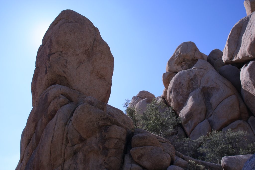
When you enter Joshua Tree Park it becomes very evident how they got the name.  This has to be the largest concentration of Joshua trees anywhere.  There are also huge outcrops of boulders and rock all stacked up like God playing with building blocks.  The hike started at about 4600 ft above sea level and we climbed through a wide canyon two miles to an old mine at 5050 ft.

Lost Horse Mine was discovered around 1890.  A cattle rancher (Lang) was looking in the area for a lost horse and a prospector told him of this find so he bought the claim for $1000.  The mine operated from 1894 to 1931 with the production of 10,000 ounces of gold.  Like all stories about gold mines there is determination, ingenuity and a touch of greed woven into the story.

In the photos that follow you will see that there was a fire through the area on May 24, 2009 that took out a great patch of vegetation.  Spring has only just come to this altitude as there were few wild flowers and most plants had only a small amount of green showing.  We had a beautiful day of sunshine but with a light wind it was a cool 7 C (45 F) hike.

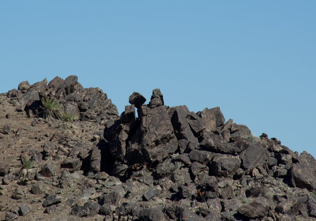
Volcanic hill with rock deposits.  The top has basalt columns that must be visited next time I hike here.


2009 fire still very evident


Rock formations really stand out with the vegetation burnt away

Mine shaft and stamp mill


Old ruins above the mine shaft. It would be great to find old photos to explain what these buildings were used for.


This winch is in line with the top of the mine shaft and was probably used to lift the ore from depth.  The shaft was 500 ft deep and had side tunnels that stretched 100 ft. 


This foundation was about 10 ft deep.  If they had a house on top of this spot it must have had a great view of the surrounding mountain ranges.


Rock piles all tumbled by nature's forces


Juniper (Juniperus californica) seems to be thriving in this cooler weather


Many varieties of Yucca are also growing in this area

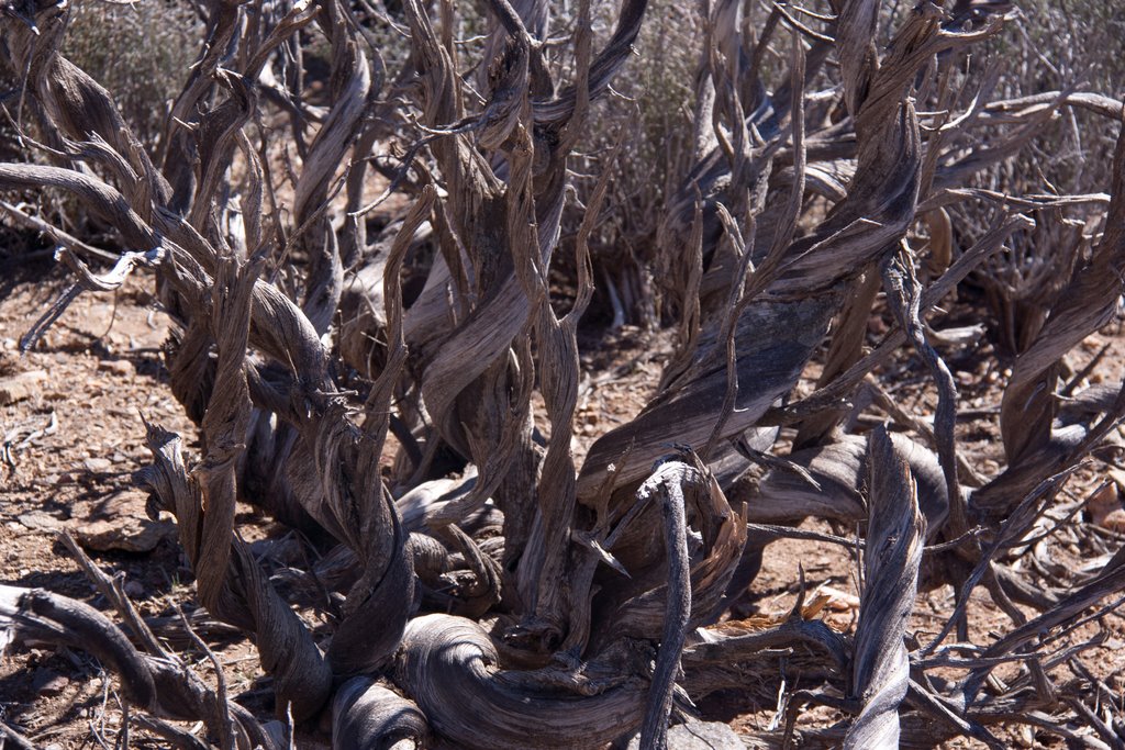
An old juniper long dead but not giving in to decay.  These twisted and gnarled limbs will be around for a very long time.

A Mojave yucca with an old bloom still attached

A Prickly Pear Cactus is finding a secure location nestled in this rock formation
The second part of trip was to Keys View a lookout in the San Bernadino Mountain Range.  Sitting at 5187 feet above sea level you get a commanding view of the Coachella Valley and the San Andreas Fault.

This guy living at the lookout will pose for handouts but I didn't feed him so he quickly left. 


The ridge in the middle of the valley is the San Andreas Fault


These rock formations are the result of volcanic activity. Magma - in this photo is a molten form of the rock called monzo-granite.  It rose from deep within the earth.  This on in particular is used by many rock climbers.


The Joshua trees have this rock formation surrounded