Friday, December 27, 2013

Murray Hill and Big Split Rock Canyon

Murray Hill has always been a tougher hike for me because of the change in elevation (2100 feet) and it is also 7 miles including the return.  We had a nice cool, clear day and we could see for miles up and down the valley.  The trail we took goes right past an oasis (Jane's Hoffbrau) and alongside a large wash before heading up the main slope.  It is one of those hikes when you think you can see the summit but once you climb some more you see there is another ridge and you have to keep going.

A selfie of me against the water tank

The planes come very close to the mountains to land in Palm Springs

San Jacinto Mountain has hardly any snow this year.

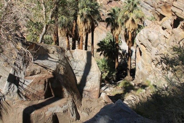
Jane's Hoffbrau Oasis and the steep wash entering from above.

You have to stay on the trail here as you would have lots of ravines to traverse if you tried a straight line route.

Two of our hikers decided to investigate the lower wash rather than having a mountain top experience.
Trail winds up and up. That peak is one of those false summits.

Easterly view of the valley

I thought this view of the vapour trails and clouds made a beautiful contrast to the mountain trail.

Bryan and I at the highest point of rock.  

There are three picnic tables up at the summit and they are great vantage points to a pleasant view.
What goes up must come down. You get a good appreciation of how steep the trail is near the top.


Last winter we tried this trail and because we had some stragglers we weren't able to make it to the end of the trail. The Big Split Rock Canyon is described as 'a lot of fun for kids'.  I just figured it out that we aren't kids anymore.  I liked the adventure as well as the others so we must be young at heart.

Start of decision making time. Left? Right? or Center?  I think left.

A bit narrow

A bit narrower...

Click on the link below and see just how narrow it gets...

Narrow enough to plug the split...


We then tried to get someone to climb this dry waterfall and see what was on the other side. It is actually the end of the trail.

We had to backtrack out of this canyon. You certainly can't get lost on this trail.

We headed up another trail to the right and someone found this dead tarantula on the path.

This canyon had many interesting shapes to it's walls.


We climbed to the top of one of the smaller hills and we could see the hills over in another canyon.

Across from the parking area the sun was shining on these rock formations.

Saturday, December 21, 2013

Whitewater Ridge and Murray Canyon Trail


This hike in the Whitewater Preserve was along a ridge that is about 800 feet over the valley and gives a good vista of both the valley and the wind turbines in the connecting valley below.  They had forecast high winds for later on in the day but we received the full force of the 30 mph wind gusts as we started to descend to the valley floor.  


The dry cottonwood tree contrasts well with the other foliage and the canyon walls

The north western edge of the ridge as we start our climb.

What made these prints?  The trail and surrounding hill were all damaged by what appeared to be a herd of animals.  We asked back at the ranger station and found out it was a herd of wild cattle that have been roaming the hills since the days of ranching in the valley.

Ridge view facing the east wall of the canyon

The patches of trail heading off in the distance is the Pacific Crest Trail. The trail is 2,650 miles (4,265 kilometers) from Mexico to Canada. 

It was only about 45 F (7 C) so to see the snow on the hill in the distance shouldn't have been a surprise.

This view of the ridge was looking south. The air quality in the lower valley was poor. 

The Whitewater River was very low but at times of rain it will flood right over this road.

These ducks are enjoying the old fish hatchery ponds at the ranger station.  I think these visitors are Tufted Ducks and aren't a regular visitor.

The second hike of the week was in the Indian Canyons, part of the Aqua Caliente Indian Reservation.  The canyons were only recently reopened after receiving a rain storm in September that caused severe flooding and land slides in the area.  There was lots of evidence of soil and vegetation removal by these flood waters.

There had been a fire in the back country and this removed vegetation that would normally hold back the soil during normal rain fall.

There are a number of hikes in the area but we went up Murray Canyon to see the waterfalls at the end.

The rock formations look like slabs of rock scales

Canyon entrance with Murray Creek flowing through the center. 

Some damage where the creek decided to go sideways

Not much vegetation except for the sturdy fan palms


Just one of the 15 crossings...


Waterfalls at the end of the trail were just a trickle
This is a picture of the falls in March 2013, note there is a pool in front of the falls.


This is a small waterfall near the Reserve Trading Post 

This is the top of the waterfall in the previous photo if you look at the rock at the top right of the picture you will see mud pasted to the top.  The rocks, mud and debris went right over the top at a height of about 20 feet.  We talked to the ranger and he said the ground shook from all the large boulders pounding down the canyon...

Thursday, December 12, 2013

Never Ending Canyon Loop and Mirage Trail

The Never Ending Canyon Loop has always been a popular hike even when you end up going up the wrong canyon.  There is at least one canyon in this area that narrows down to shoulder width and then ends.  The only safe way is to turn around. Today we went up and down all the right canyons.

The trail goes up one canyon across a ridge and down another parallel canyon. The area is always being reshaped by the wind and especially the rain.  You never know what to expect year to year or even after a small rain.


Many grand views that almost look like cathedrals.

There are always stories being told and a group of three... must be a good one.

We thought this poor bird's remains were of an eagle.  The large bones were remarkably light compared to those of a turkey.

With all the chunks of sand and clay calving off the canyon walls the trail has many detours that you have to climb around.

Photo-Op Rock...


View south to the Salton Sea

Don't step back to take pictures here.  I think the border of rocks are there as a warning.


The canyon we hiked up
The canyon we hiked down

This is the steepest part of the trail. Some people have been know to slide down this.

Heading into the final stretch to the cars.
Our second hike was the Mirage Trail aka Bump and Grind.  I have been calling it just the Bump and Grind and have had some people back out of the hike.  It is a great fitness trail that sports one steep section and the rest is quite tame.  It is very popular with the tourists and locals because it is right on the edge of the city.


One of the many washes that cut the across the trail.  You can see the boulders left behind from the water washing through during a rain.

This is the portion of trail with the steep section, I have highlighted the trail to show the zig-zag effect.

Almost to the top! In this photo you can see how close the city is.

I think trail bikes are off limits on this trail but this clever lad though extreme is going down the steepest part, forget the fact that people have to scramble to get out of his way.


I changed the colour saturation on the next photos to highlight the surrounding hills and mountains.


Amazing contrast between the golf course and surrounding hills.  Water truly does supply life around here.